ᥜᥣᥭᥱ:EU-Germany.svg
Appearance

Size of this PNG preview of this SVG file: 713 × 600 pixels. resolutions: 285 × 240 pixels | 571 × 480 pixels | 913 × 768 pixels | 1,218 × 1,024 pixels | 2,435 × 2,048 pixels | 2,045 × 1,720 pixels ᥖᥣᥒᥱ ᥟᥢ
ᥜᥣᥭᥱ ᥒᥝᥲ ᥖᥪᥢᥰ (SVG file, nominally 2,045 × 1,720 pixels, file size: 7.33 MB)
ᥙᥪᥢᥰ ᥜᥣᥭᥱ
ᥖᥥᥐᥱ ᥘᥫᥴ ᥝᥢᥰ ᥗᥤ/ᥑᥣᥝᥰ ᥕᥣᥛᥰ ᥖᥣᥱ ᥞᥢᥴ ᥜᥣᥭᥱ ᥘᥬᥰ ᥝᥢᥰ ᥘᥢᥳ.
| ᥝᥢᥰ ᥗᥤᥳ/ᥑᥣᥝᥰ ᥕᥣᥛᥰ | ᥞᥣᥒ ᥘᥥᥐᥳ | ᥔᥦᥢᥰ ᥛᥢᥰ | ᥚᥧᥱ ᥓᥬᥳ ᥖᥪᥰ | ᥖᥣᥒᥰ ᥞᥢᥴ ᥗᥪᥒᥴ | |
|---|---|---|---|---|---|
| ᥕᥣᥛᥰ ᥘᥥᥝ | 11:07, 1 ᥜᥦᥙᥱ ᥝᥣᥱ ᥘᥤᥱ 2020 |  | 2,045 × 1,720 (7.33 MB) | Rob984 | UK and Gibraltar have left the EU. New base which includes all of Portugal's islands within frame, as well as Arctic Russian islands part of Europe. Also fixed Flevoland in the Netherlands. |
| 16:47, 16 ᥓᥧᥢᥱ 2016 | 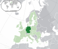 | 2,045 × 1,720 (6.97 MB) | Lord Obvious | Making German island dark instead of light green. | |
| 02:35, 20 ᥟᥥᥱ ᥙᥫᥱ 2016 |  | 2,045 × 1,720 (6.96 MB) | Tubezlob | in the world map: Germany in green instead of light-green and Austria in light-green instead of green | |
| 15:59, 24 ᥖᥤᥱ ᥔᥦᥛᥱ ᥙᥣᥱ 2015 |  | 2,045 × 1,720 (7.33 MB) | Nordwestern | Per original framework and Commons' rules. Agree with A2D2. | |
| 22:29, 18 ᥛᥣᥖᥳ 2015 |  | 2,045 × 1,720 (7.38 MB) | Mapclean | Reverted to Leftcry's version, please go to your talk page | |
| 20:38, 21 ᥜᥦᥙᥱ ᥝᥣᥱ ᥘᥤᥱ 2015 |  | 2,045 × 1,720 (2.62 MB) | VS6507 | Spain. Greece. Slovakia. Cyprus. Romania VETO | |
| 02:08, 17 ᥢᥨᥝᥱ ᥝᥦᥛᥱ ᥙᥣᥱ 2014 |  | 2,045 × 1,720 (7.38 MB) | Leftcry | Reverted to version as of 15:34, 6 August 2014 Please go to your talk page | |
| 23:00, 16 ᥢᥨᥝᥱ ᥝᥦᥛᥱ ᥙᥣᥱ 2014 |  | 2,045 × 1,720 (2.62 MB) | A2D2 | The map must show the original de-jure status with no breakaway regions, as it was originally created. An alternative map showing the de-facto status with breakaway regions needs to be created instead. | |
| 22:19, 16 ᥢᥨᥝᥱ ᥝᥦᥛᥱ ᥙᥣᥱ 2014 |  | 2,045 × 1,720 (7.38 MB) | A2D2 | Reverted to version as of 10:32, 13 July 2014 | |
| 22:04, 6 ᥟᥨᥝᥰ ᥐᥣᥖᥳ 2014 |  | 2,045 × 1,720 (7.38 MB) | Rob984 | Sudan |
ᥘᥩᥒ ᥓᥬᥳ ᥖᥪᥰ ᥜᥣᥭᥱ
ᥘᥣᥲ ᥘᥤᥐ ᥐᥩᥒᥳ ᥛᥣᥰ ᥓᥧᥰ ᥜᥣᥭᥱ ᥘᥭᥳ:
ᥘᥩᥒ ᥓᥬᥳ ᥖᥪᥰ ᥜᥣᥭᥱ ᥘᥨᥛ ᥚᥣᥳ ᥙᥧᥢᥳ ᥖᥤ ᥙᥣᥱ
ᥝᥤᥱ ᥑᥤᥱ ᥓᥫᥰ ᥟᥢ ᥖᥪᥰ ᥝᥭᥳ ᥜᥣᥭᥱ ᥟᥢ ᥘᥭᥳ:
- ᥖᥪᥰ ᥝᥭᥳ ady.wikipedia.org
- ᥖᥪᥰ ᥝᥭᥳ af.wikipedia.org
- ᥖᥪᥰ ᥝᥭᥳ af.wiktionary.org
- ᥖᥪᥰ ᥝᥭᥳ ami.wikipedia.org
- ᥖᥪᥰ ᥝᥭᥳ ang.wikipedia.org
- ᥖᥪᥰ ᥝᥭᥳ ar.wikipedia.org
- معاملة المثليين في ألمانيا
- فريدريش تساندر
- إدوارد مولر
- هانس مولر (سياسي)
- فيرنر ويبر
- جورج شميد
- الأمير أنتون من هوهنتسولرن-سيغمارينغن
- كاترين غورنغ إيكارت
- مستخدم:ElWaliElAlaoui/ملعب 8
- ألفرد مولر
- بول مولر (رياضياتي)
- بيتر لودفيغ
- فريدريش بولو
- بول مولر (أحيائي)
- إميل هانسن (رسام)
- مستخدم:جار الله/قائمة صور مقالات العلاقات الثنائية
- العلاقات الألمانية الأنغولية
- العلاقات الألمانية الكورية الجنوبية
- العلاقات الألمانية الإريترية
- العلاقات الألمانية السويسرية
- العلاقات الألمانية الليختنشتانية
- العلاقات الألمانية البوليفية
- العلاقات الألمانية الموزمبيقية
- العلاقات الألبانية الألمانية
- العلاقات الألمانية البلجيكية
- العلاقات الألمانية الإثيوبية
- العلاقات الألمانية البيلاروسية
- العلاقات الألمانية الطاجيكستانية
- العلاقات الألمانية الرومانية
- العلاقات الألمانية الأرجنتينية
- العلاقات الألمانية الغامبية
- العلاقات الألمانية القبرصية
- العلاقات الألمانية السيراليونية
- العلاقات الألمانية النيبالية
- العلاقات الألمانية الليبيرية
- العلاقات الألمانية الميانمارية
- العلاقات الألمانية الكندية
- العلاقات الألمانية الزيمبابوية
- العلاقات الألمانية البالاوية
- العلاقات الألمانية المالية
- العلاقات الألمانية النيجيرية
- العلاقات الألمانية اليمنية
- العلاقات الألمانية الفانواتية
- العلاقات الألمانية الغابونية
- العلاقات الألمانية البنمية
ᥖᥨᥭᥰ ᥜᥣᥭᥱmore global usage ᥟᥢ ᥘᥭᥳ.


